Page 5 of 9
Re: Friday Facts #180 - Map interaction
Posted: Fri Mar 03, 2017 9:29 pm
by hitzu
The electric network visualisation
This one might be especially useful when you want to find out the reason of electricity breach. As with the previous one, it gives even more incentive to build electric network in OCD friendly way, as all the circumstantial electric pole placements are more than visible in this view.
Yay! Magnificent! Could you make so the different electric networks were in different colors as well?
And also the option to rotate train stations names.
Re: Friday Facts #180 - Map interaction
Posted: Fri Mar 03, 2017 9:33 pm
by GuiltyBystander
Small request for the electric grid map, draw each electric grid in a different color. Too often, you accidentally clip a pole or forget to hookup your new steam/solar to the main grid. If each separate electric grid had it's own unique color, you'd be able to spot these problems a lot sooner.
Similar problems can happen with the roboport networks, but I feel they happen less often.
Re: Friday Facts #180 - Map interaction
Posted: Fri Mar 03, 2017 9:35 pm
by DukeAl
This looks really awesome. What i would like to see is
1. hide mini map when map is open
2. option to hide terrain (black background) and only show:
-buildings
-train network
-ores (select a specific ore/show all ores)
-aliens
-trees
edit: thinking about it, hide all ui elements when the map is open (toolbelt,armor/weapons)
Re: Friday Facts #180 - Map interaction
Posted: Fri Mar 03, 2017 9:35 pm
by Gandalf
> Interactive (clickable) electric and logistics networks that open the window with detailed info.
I imagine it might be fairly simple to highlight / outline individual power networks on cursor hover on the map. I.e. if the setting is toggled on and you hover the cursor over any part of a network it'll show that entire network in a brighter color, but not any other power network. That would make it very easy to identify disconnected parts of the factory. The same could be done for the logistics network.
Re: Friday Facts #180 - Map interaction
Posted: Fri Mar 03, 2017 9:36 pm
by Dooces
Re: Friday Facts #180 - Map interaction
Posted: Fri Mar 03, 2017 9:44 pm
by ssilk
Addition: I want to see for the rail network especially the "cuts".
So you see it imediatelly?
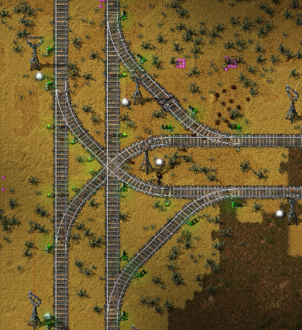
- Screen Shot 2017-03-03 at 22.40.57.png (523.04 KiB) Viewed 7516 times
PS: On dark ground this is really hard to see...
Re: Friday Facts #180 - Map interaction
Posted: Fri Mar 03, 2017 9:46 pm
by bbgun06
Better map colors, more different colors for entities,
If you can't wait: try osldgoth's Enhanced Map Colors:
https://mods.factorio.com/mods/osldgoth ... Map_Colors
Re: Friday Facts #180 - Map interaction
Posted: Fri Mar 03, 2017 10:04 pm
by DerivePi
Include a way to select which players' "artwork" shows up on the minimap.
Re: Friday Facts #180 - Map interaction
Posted: Fri Mar 03, 2017 10:05 pm
by hitzu
And guys, if you really want to make the game to be more colorblind friendly then remember that the most contrast colors pair for normal vision people - red and green - don't work on colorblind people. So the
red pollution on the
green map for them looks like
yellow pollution on the
yellow map. Also most of them don't differentiate blue and purple. So the most informative color of the pollution for them would be either blue (hard to see on water) or black.

Re: Friday Facts #180 - Map interaction
Posted: Fri Mar 03, 2017 11:20 pm
by Tournesol
I would like a map that just show logistic bots. Possibly color* coded as well, so that type and status like 'out of power', 'on route to pick up', 'delivering item', 'repairing' and 'done and returning to roboport'. Perhaps a mode that show the current % charge in the robots too?
A potentially very useful map would be a current machine state mode: Color* the map so that running machines are green, input blocked are red, and output blocked are yellow. This will give a very good way of spotting errors and problems in large setups like smelting. It's similar to the Bottleneck mod, but with no other distractions and on a larger scale.
*Make the colors/patterns configurable from file, so that people can make colorblind mods.
Re: Friday Facts #180 - Map interaction
Posted: Fri Mar 03, 2017 11:21 pm
by cncr04s
For god sakes, give us a fluids usage/ production graph.
Re: Friday Facts #180 - Map interaction
Posted: Fri Mar 03, 2017 11:31 pm
by Kane
ssilk wrote:Addition: I want to see for the rail network especially the "cuts".
So you see it imediatelly?
Screen Shot 2017-03-03 at 22.40.57.png
PS: On dark ground this is really hard to see...
Yes I love to have more info about the rail system via the map and things like cuts/breaks.
Re: Friday Facts #180 - Map interaction
Posted: Sat Mar 04, 2017 12:28 am
by Mimp
Fantastic job on this overhaul, I'm really looking forward to having it in game.
mrzorn wrote:I would like to suggest a Map View Mode where you can see the separated signal blocks of a train network with the corresponding colour indicating its status.
I second this. I've had times where a signal got removed or never got placed and the blocks were much larger than intended. This would help identify those areas extremely quickly.
Jonathan88 wrote:I love the fact that the devs just straight out acknowledge that people will just draw random genitalia!

They don't pretend they don't know who they're dealing with...
Yeah, I can just imagine the dickbutt base where everything looks like a normal spaghetti base until you open the power grid view...
Re: Friday Facts #180 - Map interaction
Posted: Sat Mar 04, 2017 1:26 am
by SHiRKiT
kovarex wrote:I don't doubt that people will use it to draw penises or other 'creative art' on the map as well.
Ah, loved to see that, Because it is obvious!
I'd be glad as well if you allow us to "hide" the entities (belts, train paths, factories) from the map on the Eletric Network view, otherwise it feels cluttered.
Re: Friday Facts #180 - Map interaction
Posted: Sat Mar 04, 2017 1:27 am
by Arbee81
As one of those colorblind people who has trouble differentiating copper from stone on the map: THANK YOU!!
Along the same lines, while copper and stone can be tough, pollution is practically impossible for me to see on the map. If there could be a toggle that switches it to higher contrast, or makes the pollution clouds opaque, or just turns the ground uniform black or something along those lines that would make such a difference. Usually the only way I can see it is when it's being absorbed by biter bases and I notice the map square flickering a little
Re: Friday Facts #180 - Map interaction
Posted: Sat Mar 04, 2017 3:06 am
by chakrit
posila wrote:chakrit wrote:Everytime I see a "I'm workin on this new shiny thing" now I read that as "we dont think 0.15 is perfect enough, its still missing this shiny new thing, what's wrong with waiting one more week?"
But it really means "while most of the team still works on finishing big features for 0.15, I having my feature done, wanted to do something small in meantime"
Totally understand, thus the EDIT. I work as a programmer myself, this is typical, but that is also all the more reason why this is painful cause you can't do anything to change it even if you know you have the skill to do so. This thing is not open source and the only thing you can do is wait. At least please take that as me really liking the game. The problem being all the other simulation games I have are all exhausted and Factorio is about the only decent fun thing I have left to on the machine haha. Since Feb, every time there's a new FF posted, I can't help but wish it'd be a "hey we'd dropped the first beta for 0.15, enjoy!" post.
Re: Friday Facts #180 - Map interaction
Posted: Sat Mar 04, 2017 6:27 am
by mattj256
sabriath wrote:
3. Have a "heat" map based on how much electricity objects are using.
+1
If I have a lot of steam engines all next to each other, I'd like the steam engine icon to appear automatically. Same for solar+accumulators. Same for assembling machines that all have the same recipe.
The power grid view should show anything that produces power, and there should be a way to distinguish between different electric networks.
Re: Friday Facts #180 - Map interaction
Posted: Sat Mar 04, 2017 7:29 am
by aka13
Now I don't post frequently, but this is some amazing QOL improvements! The ore deposit thing alone is going to be amazing if implemented.
Re: Friday Facts #180 - Map interaction
Posted: Sat Mar 04, 2017 7:35 am
by g1franc
Can wait for the 0.15 first experimental release
Re: Friday Facts #180 - Map interaction
Posted: Sat Mar 04, 2017 7:46 am
by Sigma1
I can't wait for all this! Especially I like the electric overlay. Also, are the new biomes you showed in one earlier FFF coming for .15 too? And I have a suggestion too: allow us to toggle the alert icons (no power, etc.)on or off in the normal view


